##ciekawa_strona##
Sudan (2005)
Sudan - select year:
Compare with other popular countries
Sudan 2005 year
 | Sudan (2001) (compare) |
 | Sudan (2002) (compare) |
 | Sudan (2003) (compare) |
 | Sudan (2004) (compare) |
 | Sudan (2006) (compare) |
 | Sudan (2007) (compare) |
| Sudan (2008) (compare) |
Compare with other popular countries
Sudan 2005 year
 | |
| Administrative divisions | 26 states (wilayat, singular - wilayah); A'ali an Nil (Upper Nile), Al Bahr al Ahmar (Red Sea), Al Buhayrat (Lakes), Al Jazirah (El Gezira), Al Khartum (Khartoum), Al Qadarif (Gedaref), Al Wahdah (Unity), An Nil al Abyad (White Nile), An Nil al Azraq (Blue Nile), Ash Shamaliyah (Northern), Bahr al Jabal (Bahr al Jabal), Gharb al Istiwa'iyah (Western Equatoria), Gharb Bahr al Ghazal (Western Bahr al Ghazal), Gharb Darfur (Western Darfur), Gharb Kurdufan (Western Kordofan), Janub Darfur (Southern Darfur), Janub Kurdufan (Southern Kordofan), Junqali (Jonglei), Kassala (Kassala), Nahr an Nil (Nile), Shamal Bahr al Ghazal (Northern Bahr al Ghazal), Shamal Darfur (Northern Darfur), Shamal Kurdufan (Northern Kordofan), Sharq al Istiwa'iyah (Eastern Equatoria), Sinnar (Sinnar), Warab (Warab) |
| Age structure | 0-14 years: 43.2% (male 8,865,331/female 8,488,982)
15-64 years: 54.5% (male 10,952,566/female 10,930,218) 65 years and over: 2.4% (male 513,679/female 436,710) (2005 est.) |
| Agriculture - products | cotton, groundnuts (peanuts), sorghum, millet, wheat, gum arabic, sugarcane, cassava (tapioca), mangos, papaya, bananas, sweet potatoes, sesame; sheep, livestock |
| Airports | 75 (2004 est.) |
| Airports - with paved runways | total: 12
over 3,047 m: 1 2,438 to 3,047 m: 8 1,524 to 2,437 m: 3 (2004 est.) |
| Airports - with unpaved runways | total: 63
over 3,047 m: 1 2,438 to 3,047 m: 1 1,524 to 2,437 m: 17 914 to 1,523 m: 33 under 914 m: 11 (2004 est.) |
| Area | total: 2,505,810 sq km
land: 2.376 million sq km water: 129,810 sq km |
| Area - comparative | slightly more than one-quarter the size of the US |
| Background | Military regimes favoring Islamic-oriented governments have dominated national politics since independence from the UK in 1956. Sudan was embroiled in two prolonged civil wars during most of the remainder of the 20th century. These conflicts were rooted in northern economic, political, and social domination of non-Muslim, non-Arab southern Sudanese. The first civil war ended in 1972, but broke out again in 1983. The second war and famine-related effects resulted in more than 2 million deaths and over 4 million people displaced over a period of two decades. Peace talks gained momentum in 2002-04 with the signing of several accords; a final Naivasha peace treaty of January 2005 granted the southern rebels autonomy for six years, after which a referendum for independence is scheduled to be held. A separate conflict that broke out in the western region of Darfur in 2003 resulted in tens of thousands of deaths and over 1 million displaced, but by early 2005, peackeeping troops had stabilized the situation. |
| Birth rate | 35.17 births/1,000 population (2005 est.) |
| Budget | revenues: $3.057 billion
expenditures: $2.965 billion, including capital expenditures of $304 million (2004 est.) |
| Capital | Khartoum |
| Climate | tropical in south; arid desert in north; rainy season varies by region (April to November) |
| Coastline | 853 km |
| Constitution | 12 April 1973; suspended following coup of 6 April 1985; interim constitution of 10 October 1985 suspended following coup of 30 June 1989; new constitution implemented on 30 June 1998 partially suspended 12 December 1999 by President BASHIR |
| Country name | conventional long form: Republic of the Sudan
conventional short form: Sudan local long form: Jumhuriyat as-Sudan local short form: As-Sudan former: Anglo-Egyptian Sudan |
| Death rate | 9.16 deaths/1,000 population (2005 est.) |
| Debt - external | $21 billion (2004 est.) |
| Diplomatic representation from the US | chief of mission: Ambassador (vacant); Charge d'Affaires Gerard M. GALLUCCI
embassy: Sharia Abdul Latif Avenue, Khartoum mailing address: P. O. Box 699, Khartoum; APO AE 09829 telephone: [249] (11) 774611 or 774700 FAX: [249] (11) 774137 note: US Consul in Cairo is providing backup service for Khartoum |
| Diplomatic representation in the US | chief of mission: Ambassador (vacant); Charge d'Affaires, Ad Interim Khidir Haroun AHMED (since April 2001)
chancery: 2210 Massachusetts Avenue NW, Washington, DC 20008 telephone: [1] (202) 338-8565 FAX: [1] (202) 667-2406 |
| Disputes - international | the effects of Sudan's almost constant ethnic and rebel militia fighting since the mid-twentieth century have penetrated all of its border states who provide shelter for fleeing refugees and cover to disparate domestic and foreign conflicting elements; since 2003, Janjawid armed militia and Sudanese military have driven about 200,000 Darfur region refugees into eastern Chad; large numbers of Sudanese refugees have also fled to Uganda, Ethiopia, Kenya, the Central African Republic, and the Democratic Republic of the Congo; southern Sudan provides shelter to Ugandans seeking periodic protection from soldiers of the Lord's Resistance Army; Sudan accuses Eritrea of supporting Sudanese rebel groups; efforts to demarcate the porous boundary with Ethiopia have been delayed by civil and ethnic fighting in Sudan; Kenya's administrative boundary extends into the southern Sudan, creating the "Ilemi Triangle"; Egypt and Sudan retain claims to administer triangular areas that extend north and south of the 1899 Treaty boundary along the 22nd Parallel, but have withdrawn their military presence; Egypt is economically developing the "Hala'ib Triangle" north of the Treaty Line; periodic violent skirmishes with Sudanese residents over water and grazing rights persist among related pastoral populations from the Central African Republic along the border |
| Economic aid - recipient | $172 million (2001) |
| Economy - overview | Sudan has turned around a struggling economy with sound economic policies and infrastructure investments, but it still faces formidable economic problems, starting from its low level of per capita output. From 1997 to date, Sudan has been implementing IMF macroeconomic reforms. In 1999, Sudan began exporting crude oil and in the last quarter of 1999 recorded its first trade surplus, which, along with monetary policy, has stabilized the exchange rate. Increased oil production, revived light industry, and expanded export processing zones helped sustain GDP growth at 6.4% in 2004. Agriculture production remains Sudan's most important sector, employing 80% of the work force, contributing 39% of GDP, and accounting for most of GDP growth, but most farms remain rain-fed and susceptible to drought. Chronic instability - including the long-standing civil war between the Muslim north and the Christian/pagan south, adverse weather, and weak world agricultural prices - ensure that much of the population will remain at or below the poverty line for years. |
| Electricity - consumption | 2.4 billion kWh (2002) |
| Electricity - exports | 0 kWh (2002) |
| Electricity - imports | 0 kWh (2002) |
| Electricity - production | 2.581 billion kWh (2002) |
| Elevation extremes | lowest point: Red Sea 0 m
highest point: Kinyeti 3,187 m |
| Environment - current issues | inadequate supplies of potable water; wildlife populations threatened by excessive hunting; soil erosion; desertification; periodic drought |
| Environment - international agreements | party to: Biodiversity, Climate Change, Climate Change-Kyoto Protocol, Desertification, Endangered Species, Law of the Sea, Ozone Layer Protection
signed, but not ratified: none of the selected agreements |
| Ethnic groups | black 52%, Arab 39%, Beja 6%, foreigners 2%, other 1% |
| Exchange rates | Sudanese dinars per US dollar - 257.91 (2004), 260.98 (2003), 263.31 (2002), 258.7 (2001), 257.12 (2000) |
| Executive branch | chief of state: President Lt. Gen. Umar Hassan Ahmad al-BASHIR (since 16 October 1993); First Vice President Salva KIIR (since 4 August 2005), Second Vice President Ali Osman TAHA (since 20 September 2005); note - the president is both the chief of state and head of government
head of government: President Lt. Gen. Umar Hassan Ahmad al-BASHIR (since 16 October 1993); First Vice President Salva KIIR (since 4 August 2005), Second Vice President Ali Osman TAHA (since 20 September 2005); note - the president is both the chief of state and head of government cabinet: Council of Ministers appointed by the president; note - the National Congress Party or NCP (formerly the National Islamic Front or NIF) dominates al-BASHIR's cabinet elections: president elected by popular vote for a five-year term; election last held 13-23 December 2000 (next to be held NA) election results: Field Marshall Umar Hassan Ahmad al-BASHIR reelected president; percent of vote - Umar Hassan Ahmad al-BASHIR 86.5%, Ja'afar Muhammed NUMAYRI 9.6%, three other candidates received a combined vote of 3.9%; election widely viewed as rigged; all popular opposition parties boycotted elections because of a lack of guarantees for a free and fair election note: al-BASHIR assumed power as chairman of Sudan's Revolutionary Command Council for National Salvation (RCC) in June 1989 and served concurrently as chief of state, chairman of the RCC, prime minister, and minister of defense until mid-October 1993 when he was appointed president by the RCC; he was elected president by popular vote for the first time in March 1996 |
| Exports | 0 kWh (2002) |
| Exports | $3.395 billion f.o.b. (2004 est.) |
| Exports | 275,000 bbl/day (2004) |
| Exports - commodities | oil and petroleum products; cotton, sesame, livestock, groundnuts, gum arabic, sugar |
| Exports - partners | China 66.9%, Japan 10.7%, Saudi Arabia 4.4% (2004) |
| Fiscal year | calendar year |
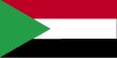
| Flag description | three equal horizontal bands of red (top), white, and black with a green isosceles triangle based on the hoist side |
| GDP - composition by sector | agriculture: 38.7%
industry: 20.3% services: 41% (2003 est.) |
| GDP - per capita | purchasing power parity - $1,900 (2004 est.) |
| GDP - real growth rate | 6.4% (2004 est.) |
| Geographic coordinates | 15 00 N, 30 00 E |
| Geography - note | largest country in Africa; dominated by the Nile and its tributaries |
| Heliports | 2 (2004 est.) |
| Highways | total: 11,900 km
paved: 4,320 km unpaved: 7,580 km (1999 est.) |
| Household income or consumption by percentage share | lowest 10%: NA
highest 10%: NA |
| Imports | 0 kWh (2002) |
| Imports | $3.496 billion f.o.b. (2004 est.) |
| Imports | 0 bbl/day (2004) |
| Imports - commodities | foodstuffs, manufactured goods, refinery and transport equipment, medicines and chemicals, textiles, wheat |
| Imports - partners | China 13%, Saudi Arabia 11.5%, UAE 5.9%, Egypt 5.1%, India 4.8%, Germany 4.5%, Australia 4.1%, Japan 4% (2004) |
| Independence | 1 January 1956 (from Egypt and UK) |
| Industrial production growth rate | 8.5% (1999 est.) |
| Industries | oil, cotton ginning, textiles, cement, edible oils, sugar, soap distilling, shoes, petroleum refining, pharmaceuticals, armaments, automobile/light truck assembly |
| Infant mortality rate | total: 62.5 deaths/1,000 live births
male: 63.29 deaths/1,000 live births female: 61.67 deaths/1,000 live births (2005 est.) |
| Inflation rate (consumer prices) | 9% (2004 est.) |
| International organization participation | ABEDA, ACP, AfDB, AFESD, AMF, AU, CAEU, FAO, G-77, IAEA, IBRD, ICAO, ICCt (signatory), ICRM, IDA, IDB, IFAD, IFC, IFRCS, IGAD, ILO, IMF, IMO, Interpol, IOC, IOM, ISO, ITU, LAS, MIGA, NAM, OIC, OPCW, PCA, UN, UNCTAD, UNESCO, UNHCR, UNIDO, UPU, WCO, WFTU, WHO, WIPO, WMO, WToO, WTO (observer) |
| Irrigated land | 19,500 sq km (1998 est.) |
| Judicial branch | Supreme Court; Special Revolutionary Courts |
| Labor force | 11 million (1996 est.) |
| Labor force - by occupation | agriculture 80%, industry and commerce 7%, government 13% (1998 est.) |
| Land boundaries | total: 7,687 km
border countries: Central African Republic 1,165 km, Chad 1,360 km, Democratic Republic of the Congo 628 km, Egypt 1,273 km, Eritrea 605 km, Ethiopia 1,606 km, Kenya 232 km, Libya 383 km, Uganda 435 km |
| Land use | arable land: 6.83%
permanent crops: 0.18% other: 92.99% (2001) |
| Languages | Arabic (official), Nubian, Ta Bedawie, diverse dialects of Nilotic, Nilo-Hamitic, Sudanic languages, English
note: program of "Arabization" in process |
| Legal system | based on English common law and Islamic law; as of 20 January 1991, the now defunct Revolutionary Command Council imposed Islamic law in the northern states; Islamic law applies to all residents of the northern states regardless of their religion; some separate religious courts; accepts compulsory ICJ jurisdiction, with reservations |
| Legislative branch | unicameral National Assembly (360 seats; 270 popularly elected, 90 elected by supra assembly of interest groups known as National Congress; members serve four-year terms)
elections: last held 13-22 December 2000 (next to be held NA) election results: NCP 355, others 5 |
| Life expectancy at birth | total population: 58.54 years
male: 57.33 years female: 59.8 years (2005 est.) |
| Literacy | definition: age 15 and over can read and write
total population: 61.1% male: 71.8% female: 50.5% (2003 est.) |
| Location | Northern Africa, bordering the Red Sea, between Egypt and Eritrea |
| Map references | Africa |
| Maritime claims | territorial sea: 12 nm
contiguous zone: 18 nm continental shelf: 200-m depth or to the depth of exploitation |
| Merchant marine | total: 2 ships (1,000 GRT or over) 20,466 GRT/26,973 DWT
by type: cargo 1, livestock carrier 1 registered in other countries: 2 (2005) |
| Military branches | Sudanese People's Armed Forces (SPAF): Army, Navy, Air Force, Popular Defense Force |
| Military expenditures - dollar figure | $587 million (2001 est.) (2004) |
| Military expenditures - percent of GDP | 3% (1999) (2004) |
| National holiday | Independence Day, 1 January (1956) |
| Nationality | noun: Sudanese (singular and plural)
adjective: Sudanese |
| Natural hazards | dust storms and periodic persistent droughts |
| Natural resources | petroleum; small reserves of iron ore, copper, chromium ore, zinc, tungsten, mica, silver, gold, hydropower |
| Net migration rate | -0.02 migrant(s)/1,000 population (2005 est.) |
| Pipelines | gas 156 km; oil 2,365 km; refined products 810 km (2004) |
| Political parties and leaders | the government allows political "associations" under a 1998 law revised in 2000; to obtain government approval parties must accept the constitution and refrain from advocating or using violence against the regime; approved parties include the National Congress Party or NCP [Ibrahim Ahmed UMAR], Popular National Congress or PNC [Hassan al-TURABI], and over 20 minor, pro-government parties |
| Political pressure groups and leaders | Democratic Unionist Party [Muhammed Uthman AL-MIRGHANI]; National Democratic Alliance [Muhammed Uthman AL-MIRGHANI, chairman]; Sudan People's Liberation Movement/Army [Dr. John GARANG]; Umma Party [Sadiq al-MAHDI] |
| Population | 40,187,486 (July 2005 est.) |
| Population below poverty line | 40% (2004 est.) |
| Population growth rate | 2.6% (2005 est.) |
| Ports and harbors | Port Sudan |
| Radio broadcast stations | AM 12, FM 1, shortwave 1 (1998) |
| Railways | total: 5,995 km
narrow gauge: 4,595 km 1.067-m gauge; 1,400 km .600-m gauge for cotton plantations (2004) |
| Religions | Sunni Muslim 70% (in north), indigenous beliefs 25%, Christian 5% (mostly in south and Khartoum) |
| Sex ratio | at birth: 1.05 male(s)/female
under 15 years: 1.04 male(s)/female 15-64 years: 1 male(s)/female 65 years and over: 1.18 male(s)/female total population: 1.02 male(s)/female (2005 est.) |
| Suffrage | 17 years of age; universal, but noncompulsory |
| Telephone system | general assessment: large, well-equipped system by regional standards and being upgraded; cellular communications started in 1996 and have expanded substantially
domestic: consists of microwave radio relay, cable, radiotelephone communications, tropospheric scatter, and a domestic satellite system with 14 earth stations international: country code - 249; satellite earth stations - 1 Intelsat (Atlantic Ocean) and 1 Arabsat (2000) |
| Telephones - main lines in use | 900,000 (2003) |
| Telephones - mobile cellular | 650,000 (2003) |
| Television broadcast stations | 3 (1997) |
| Terrain | generally flat, featureless plain; mountains in far south, northeast and west; desert dominates the north |
| Total fertility rate | 4.85 children born/woman (2005 est.) |
| Unemployment rate | 18.7% (2002 est.) |
| Waterways | 4,068 km (1,723 km open year round on White and Blue Nile rivers) (2004) |
Sitemap:
Compare countries listing (map site) |
Country listing (map site)
Links: Add to favorites | Information about this website | Stats | Polityka prywatnosci
This page was generated in ##czas## s. Size this page: ##rozmiar_strony## kB.
Links: Add to favorites | Information about this website | Stats | Polityka prywatnosci
This page was generated in ##czas## s. Size this page: ##rozmiar_strony## kB.