##ciekawa_strona##
Montenegro (2007)
Montenegro - select year:
Compare with other popular countries:
Montenegro 2007 year
 | Montenegro (2006) (compare) |
 | Montenegro (2008) (compare) |
Compare with other popular countries:
Montenegro 2007 year
 | |
| Administrative divisions | 21 municipalities (opstini, singular - opstina); Andrijevica, Bar, Berane, Bijelo Polje, Budva, Cetinje, Danilovgrad, Herceg Novi, Kolasin, Kotor, Mojkovac, Niksic, Plav, Pluzine, Pljevlja, Podgorica, Rozaje, Savnik, Tivat, Ulcinj, Zabljak |
| Agriculture - products | grains, tobacco, potatoes, citrus fruits, olives, grapes; sheepherding; commercial fishing negligible |
| Airports | 5 (2007) |
| Airports - with paved runways | total: 3
2,438 to 3,047 m: 2 1,524 to 2,437 m: 1 (2007) |
| Airports - with unpaved runways | total: 2
914 to 1,523 m: 1 under 914 m: 1 (2007) |
| Area | total: 14,026 sq km
land: 13,812 sq km water: 214 sq km |
| Area - comparative | slightly smaller than Connecticut |
| Background | The use of the name Montenegro began in the 15th century when the Crnojevic dynasty began to rule the Serbian principality of Zeta; over subsequent centuries Montenegro was able to maintain its independence from the Ottoman Empire. From the 16th to 19th centuries, Montenegro became a theocracy ruled by a series of bishop princes; in 1852, it was transformed into a secular principality. After World War I, Montenegro was absorbed by the Kingdom of Serbs, Croats, and Slovenes, which became the Kingdom of Yugoslavia in 1929; at the conclusion of World War II, it became a constituent republic of the Socialist Federal Republic of Yugoslavia. When the latter dissolved in 1992, Montenegro federated with Serbia, first as the Federal Republic of Yugoslavia and, after 2003, in a looser union of Serbia and Montenegro. In May 2006, Montenegro invoked its right under the Constitutional Charter of Serbia and Montenegro to hold a referendum on independence from the state union. The vote for severing ties with Serbia exceeded 55% - the threshold set by the EU - allowing Montenegro to formally declare its independence on 3 June 2006. |
| Birth rate | 11.18 births/1,000 population (2007 est.) |
| Budget | revenues: NA
expenditures: NA |
| Capital | name: Podgorica (administrative capital)
geographic coordinates: 42 26 N, 19 16 E time difference: UTC+1 (6 hours ahead of Washington, DC during Standard Time) daylight saving time: +1 hr, begins last Sunday in March; ends last Sunday in October note: Cetinje (capital city) |
| Climate | Mediterranean climate, hot dry summers and autumns and relatively cold winters with heavy snowfalls inland |
| Coastline | 293.5 km |
| Constitution | 12 October 1992 (was approved by the Assembly); note - Montenegro is currently writing a new constitution set to be presented to Parliament in spring 2007 |
| Country name | conventional long form: Republic of Montenegro
conventional short form: Montenegro local long form: Republika Crna Gora local short form: Crna Gora former: People's Republic of Montenegro, Socialist Republic of Montenegro |
| Death rate | 8.39 deaths/1,000 population (2007 est.) |
| Debt - external | $NA |
| Diplomatic representation from the US | chief of mission: Ambassador Roderick W. MOORE
embassy: Ljubljanska bb, 81000 Podgorica, Montenegro mailing address: use embassy street address telephone: [382] 81 225 417 FAX: [382] 81 241 358 |
| Diplomatic representation in the US | chief of mission: Ambassador Miodrag VLAHOVIC
chancery: 1610 New Hampshire Avenue NW, Washington, DC, 20009 telephone: [1] (202) 234-6108 FAX: [1] (202) 234-6109 |
| Disputes - international | none |
| Economic aid - recipient | $NA |
| Economy - overview | The republic of Montenegro severed its economy from federal control and from Serbia during the MILOSEVIC era and maintained its own central bank, used the euro instead of the Yugoslav dinar as official currency, collected customs tariffs, and managed its own budget. The dissolution of the loose political union between Serbia and Montenegro in 2006 led to separate membership in several international financial institutions, such as the European Bank for Reconstruction and Development. On 18 January 2007, Montenegro joined the World Bank and IMF. Montenegro is pursuing its own membership in the World Trade Organization as well as negotiating a Stabilization and Association agreement with the European Union in anticipation of eventual membership. Severe unemployment remains a key political and economic problem for this entire region. Montenegro has privatized its large aluminum complex - the dominant industry - as well as most of its financial sector, and has begun to attract foreign direct investment in the tourism sector. |
| Electricity - consumption | 18.6 million kWh (2005) |
| Electricity - production | 2.864 billion kWh (2005 est.) |
| Elevation extremes | lowest point: Adriatic Sea 0 m
highest point: Bobotov Kuk 2,522 m |
| Environment - current issues | pollution of coastal waters from sewage outlets, especially in tourist-related areas such as Kotor |
| Environment - international agreements | party to: Climate Change, Hazardous Wastes, Law of the Sea, Marine Dumping, Ship Pollution |
| Ethnic groups | Montenegrin 43%, Serbian 32%, Bosniak 8%, Albanian 5%, other (Muslims, Croats, Roma (Gypsy)) 12% |
| Exchange rates | euros per US dollar - 0.7964 (2006), 0.8041 (2005), 0.8089 (2004), 0.886 (2003), 1.0626 (2002) |
| Executive branch | chief of state: President Filip VUJANOVIC (since 11 May 2003)
head of government: Prime Minister Zeljko STURANOVIC (since 13 November 2006) cabinet: Ministries act as cabinet elections: president elected by direct vote for five-year term (eligible for a second term); election last held 11 May 2003 (next to be held in 2008); prime minister proposed by president, accepted by Assembly election results: Filip VUJANOVIC elected on the third round; Filip VUJANOVIC 63.3%, Miodrag ZIVKOVIC 30.8% |
| Exports | $171.3 million (2003) |
| Exports - partners | Switzerland 83.9%, Italy 6.1%, Bosnia and Herzegovina 1.3% (2006) |
| Fiscal year | calendar year |
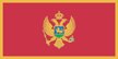
| Flag description | a red field bordered by a narrow golden-yellow stripe with the Montenegrin coat of arms centered |
| GDP - composition by sector | agriculture: NA%
industry: NA% services: NA% |
| GDP - real growth rate | NA% |
| Geographic coordinates | 42 30 N, 19 18 E |
| Geography - note | strategic location along the Adriatic coast |
| Heliports | 1 (2007) |
| Imports | $601.7 million (2003) |
| Imports - partners | Greece 10.2%, Italy 10.2%, Germany 9.6%, Bosnia and Herzegovina 9.2% (2006) |
| Independence | 3 June 2006 (from Serbia and Montenegro) |
| Industries | steelmaking, aluminum, agricultural processing, consumer goods, tourism |
| Inflation rate (consumer prices) | 3.4% (2004) |
| International organization participation | CE, CEI, EBRD, FAO, IAEA, IBRD, ICCt, ILO, IMF, IMO, Interpol, IOC, IOM, IPU, ITU, ITUC, MIGA, OPCW, OSCE, PFP, UN, UNIDO, UPU, WCO, WHO, WIPO, WMO, WTO (observer) |
| Irrigated land | NA |
| Judicial branch | Constitutional Court (five judges with nine-year terms); Supreme Court (judges have life tenure) |
| Labor force | 259,100 (2004) |
| Labor force - by occupation | agriculture: 2%
industry: 30% services: 68% (2004 est.) |
| Land boundaries | total: 625 km
border countries: Albania 172 km, Bosnia and Herzegovina 225 km, Croatia 25 km, Serbia 203 km |
| Land use | arable land: 13.7%
permanent crops: 1% other: 85.3% |
| Languages | Serbian (official; Ijekavian dialect), Bosnian, Albanian, Croatian |
| Legal system | based on civil law system; has not accepted compulsory ICJ jurisdiction |
| Legislative branch | unicameral Assembly (81 seats; members elected by direct vote for four-year terms; changed from 74 seats in 2006)
elections: last held 10 September 2006 (next to be held 2010) election results: percent of vote by party - Coalition for European Montenegro 40.6%, Serbian List 15.3%, Coalition SNP-NS-DSS 14.8%, PZP 13.9%, Liberals and Bosniaks 3.8%, other (including Albanian minority parties) 11.6%; seats by party - Coalition for European Montenegro 39, Serbian List 12, Coalition SNP/NS/DSS 11, PZP 11, Liberals and Bosniaks 3, Albanian minority parties 5 |
| Location | Southeastern Europe, between the Adriatic Sea and Serbia |
| Map references | Europe |
| Maritime claims | territorial sea: 12 nm
continental shelf: defined by treaty |
| Merchant marine | total: 4 ships (1000 GRT or over) 9,458 GRT/10,172 DWT
by type: cargo 4 registered in other countries: 3 (Bahamas 2, St Vincent and The Grenadines 1) (2007) |
| Military - note | Montenegrin plans call for the establishment of a fully professional armed forces |
| National holiday | National Day, 13 July (1878) |
| Nationality | noun: Montenegrin(s)
adjective: Montenegrin |
| Natural hazards | destructive earthquakes |
| Natural resources | bauxite, hydroelectricity |
| Political parties and leaders | Albanian Alternative or AA [Vesel SINISHTAJ]; Bosniak Party or BS [Rafet HUSOVIC]; Coalition for European Montenegro or DPS-SDP (bloc) [Milo DUKANOVIC] (includes DPS and SDP); Coalition SNP-NS-DSS (bloc) (includes SNP, NS, and DSS); Democratic League-Party of Democratic Prosperity or SPP [Mehmet BARHDI]; Democratic Party of Socialists or DPS [Milo DJUKANOVIC]; Democratic Serbian Party of Montenegro or DSS [Ranko KADIC]; Democratic Union of Albanians or DUA [Ferhat DINOSA]; Liberal Party of Montenegro or LP [Miodrag ZIVKOVIC]; Liberals and the Bosniak Party (bloc) [Miodrag ZIVKOVIC] (includes LP and BS); Movement for Changes or PZP [Nebojsa MEDOJEVIC]; Party of Serb Radicals or SSR [Dusko SEKULIC]; People's Party of Montenegro or NS [Predrag POPOVIC]; People's Socialist Party or NSS [Emilo LABUDOVIC]; Serbian List (bloc) [Andrija MANDIC] (includes SSR, NSS, and SNS); Serbian People's Party of Montenegro or SNS [Andrija MANDIC]; Social Democratic Party or SDP [Ranko KRIVOKAPIC]; Socialist People's Party or SNP [Srdjan MILIC] |
| Population | 684,736 (July 2007 est.) |
| Population below poverty line | 12.2% (2003) |
| Population growth rate | -1% (2007 est.) |
| Radio broadcast stations | 31 (station types NA) (2004) |
| Railways | total: 250 km
standard gauge: 250 km 1.435-m gauge (electrified 169 km) (2006) |
| Religions | Orthodox, Muslim, Roman Catholic |
| Suffrage | 18 years of age; universal |
| Telephone system | general assessment: modern telecommunications system with access to European satellites
domestic: GSM wireless service, available through 2 providers with national coverage, is growing rapidly international: country code - 382 (the old code of 381 used by Serbia and Montenegro will also remain in use until Feb 2007); 2 international switches connect the national system |
| Telephones - main lines in use | 353,300 (2006) |
| Telephones - mobile cellular | 821,800 (2006) |
| Television broadcast stations | 13 (2004) |
| Terrain | highly indented coastline with narrow coastal plain backed by rugged high limestone mountains and plateaus |
| Unemployment rate | 27.7% (2005) |
Sitemap:
Compare countries listing (map site) |
Country listing (map site)
Links: Add to favorites | Information about this website | Stats | Polityka prywatnosci
This page was generated in ##czas## s. Size this page: ##rozmiar_strony## kB.
Links: Add to favorites | Information about this website | Stats | Polityka prywatnosci
This page was generated in ##czas## s. Size this page: ##rozmiar_strony## kB.